Opening example data
Data from the Fal estuary
Example datasets in PRIMER can be obtained via the Help menu item. In trial mode, click Help > Get Examples Trial..., and you can download the following four files of example data (held in a folder called 'Examples Trial') to a location of your choice:
- Fal environment.pri (measured values for 12 environmental variables x 27 sites)
- Fal environment.xls (same as above, but in Excel format)
- Fal nematode abundance.pri (abundances of 62 nematode species x 27 sites)
- Fal nematode taxonomy.agg (taxonomic hierarchy for the 62 nematode species)
These data come from a study of benthic infaunal communities in soft sediments from 27 sites over five creeks of the Fal estuary, SW England ( Somerfield et al. (1994a) , Somerfield et al. (1994b) ). Sediments at these sites were contaminated to varying degrees by heavy metals, from historic mining activities. Both faunal counts (nematodes) and environmental measures were obtained from the same set of sites. (Note: the extension *.pri indicates a file containing a data matrix that has been saved in PRIMER 7's own internal (binary) format, unreadable by other software or earlier versions of PRIMER. Similarly, the *.agg extension indicates an aggregation-type file for PRIMER.)
Open the Fal data in PRIMER
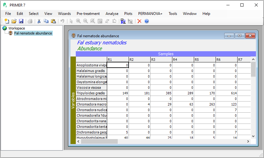
To open the species-by-samples data matrix, launch PRIMER, then click File > Open from the main menu, navigate to the 'Examples trial' directory in the location you have specified, and select 'Fal nematode abundance.pri'. Click Open to display the species matrix.
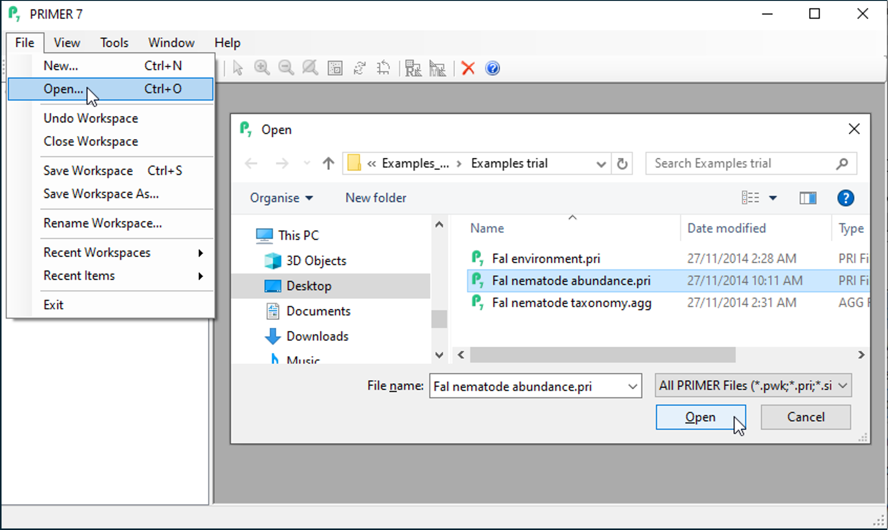
Alternatively, because this is a PRIMER file type (*.pri), you can instead use Windows Explorer to navigate to your specified folder and just double-click on the file name. This will launch a PRIMER session, with the data matrix open in the PRIMER desktop.
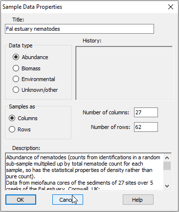
Properties of the data
Click on Edit > Properties and you will see that PRIMER-format *.pri sheets carry other information about the data matrix as well, including:
- Title,
- Data type,
- Array size (number of columns and rows),
- Orientation (whether samples are found in columns or rows),
- a Description, and
- a History of what pre-treatments (such as a transformation) have been applied to them.
Factors associated with the data
Click on Edit > Factors, and you can see that a subsidiary sheet of three factors is also linked to this worksheet: 'Creek', a single-letter abbreviation for the creeks, the full 'Creek name' and a numeric 'Position' factor identifying the location of each sampling site down each creek.
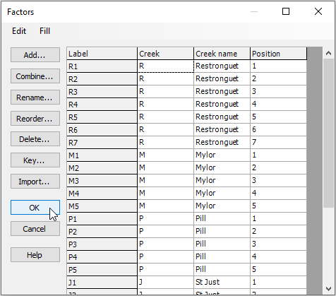
Note that additional factors could be added here by clicking Add, and also combinations of levels of existing factors can be created by clicking on Combine.